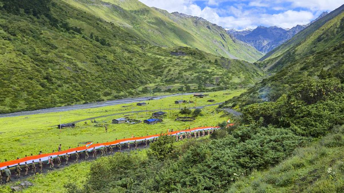

Indian Army and ITBP personnel, along with villagers and students, participate in a ‘Tiranga Rally’ ahead of Independence Day, at the forward areas of Chuna in Tawang district, Arunachal Pradesh on August 14.
| Photo Credit: PTI
In a three-part series on the India-China border issue that appeared in the columns of The Hindu from September 5-9, 2025, the author, Manoj Joshi, develops a narrative on the assertion that the India-China border was not properly defined. This article presents another view on the same.
Official Manchu maps
During the 267-year Manchu rule (1644-1911), two major maps of the Empire, drawn to scale with coordinate lines, were prepared with the assistance of European Jesuits. The first is Emperor Kang-hsi’s map (1721), depicting the territorial bequest of the Tibet-Assam segment to the then Republic of China (RoC). In the map, Tibet was never conceived as a trans-Himalayan state. Its southern boundary extended only upto the Himalayas, for Tibetans never resided on the southern side of the Himalayan divide. Consequently, non-Tibetan Tawang, south of the Himalayan divide, although Buddhist, was not depicted as Tibetan territory. Corroborative evidence in this regard comes from the RoC delegate’s statement during the Simla Conference (1913-14), in which he categorically maintained that Tibet had no claim to the territories of the tribal belt (corresponding to present day Arunachal Pradesh) on the Assam side of the Himalayan divide, for they were not ethnically Tibetan and were self-governing.
Moreover, the RoC delegate did not claim this non-Tibetan tribal-belt on behalf of his country, leaving it to the Indian delegate to include it in Assam as it had already been under its sphere of influence for centuries. The resultant Indo-Tibetan boundary agreement in March 1914, also called the 1914 alignment, was in keeping with Kang-hsi’s map.
The second Manchu map that depicts its territorial bequest to the RoC in the eastern Turkestan-Kashmir segment is Emperor Ch’ien-lung’s map (1761), which shows that Eastern Turkestan (a region in the northwestern part of the now People’s Republic of China) was never conceived as a trans-Kunlun territory (mountain range abutting eastern Turkistan). Consequently, the Manchu never claimed the stretch of desolate area south of the Kunlun mountain extending all the way upto the Hindu Kush-Karakoram mountains, lying further south. A proposal was submitted to the Manchu Foreign Office in 1899 suggesting the division of this area on the watershed principle, resulting in the Kashmir-Sinkiang boundary line, which became the 1899 alignment (related to the Aksai Chin region).
Territorial claims to the contrary
Apart from the official Manchu maps cited above, there is no subsequent official Manchu map. In 1943, when World War II was at its peak, a tottering RoC felt emboldened enough to set aside the Manchu’s territorial bequest (1721 & 1761 maps), resulting in the emergence of a claim to large tracts of Indian territory. On being questioned on the new map, the RoC’s response was, “The map was but an unprecise draft, to be corrected later on.” A similar map was repeated by the RoC in December 1947, at a vulnerable moment, when a newly independent India’s energies were directed on its military conflict with Pakistan.
China retained the same map-making pattern set by its predecessor regime. In a rare moment of candour in Peking in October 1954, Chou En-lai, the then Chinese Premier acknowledged in the presence of the Indian Prime Minister Jawaharlal Nehru, ‘…it is a historical question and we have been mostly printing old maps…At least we do not have any deliberate intentions of changing boundaries as KMT (RoC) had. The whole thing is ridiculous….’.
It has been shown that during his talks with Jawaharlal Nehru on the boundary question in New Delhi in April 1960, Chou En-lai had, more or less, conjured up a narrative in support of the Chinese position. He did so by attempting to pick holes in the evidence in support of India’s claim through a clever play of words and assertions, not backed by facts. However, he was cautious in making a reference to evidence of Chinese origin, for he knew that here he could be skating on thin ice.
He slowly revealed his tactic to resolve the boundary question: that instead of focusing on maps and documents alone, both sides should agree to the use of a set of principles, enunciated by him, for a resolution. This was a trap, as reasoned by former Foreign Secretary Vijay Gokhale in his book, The Long Game. There appears to be no evidence in the public domain to suggest that Chou En-lai had proposed a territorial swap — where India would concede to the Chinese position in the Aksai Chin region in exchange for Chinese acceptance of India’s claim over Arunachal Pradesh.
Instead, the way forward, as agreed to by both parties, was through a package deal that would aim at resolving not only the entire length of the boundary, but also address other pending geopolitical and trade-related matters. To break the impasse, both sides would need to work towards a “…solution which brings no defeat to any side and that it should be reasonable, equitable and friendly…and which is…consistent with dignity and self-respect of both countries.” The broad contours of such a solution could possibly lead to the acceptance of the 1899 and 1914 alignments respectively, with a provision for a territorial swap to meet each other’s security concerns.
The author is a former civil servant.
Published – September 24, 2025 08:30 am IST